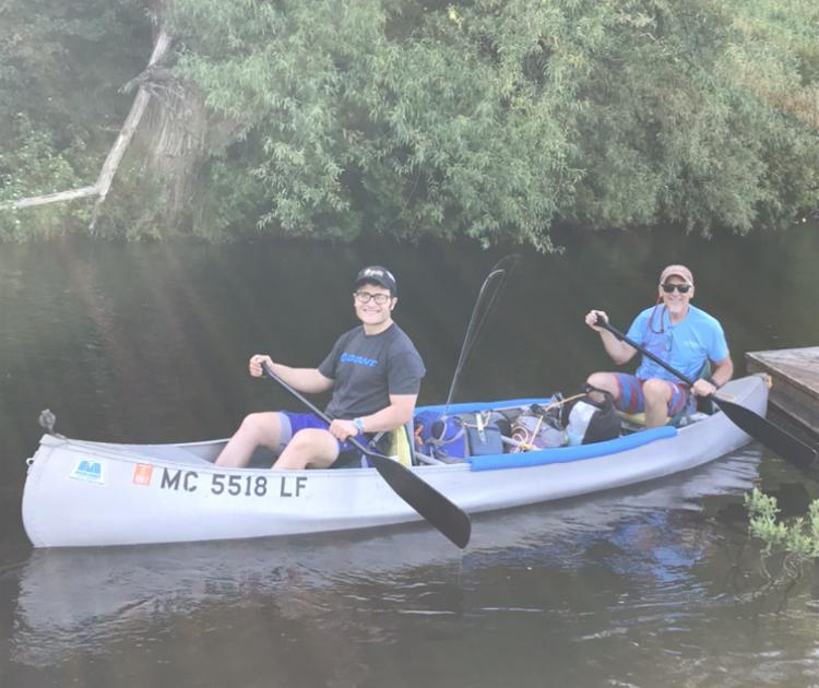
By: Ross DiFalco
Day 3
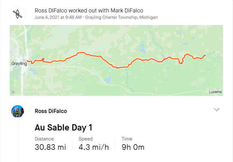
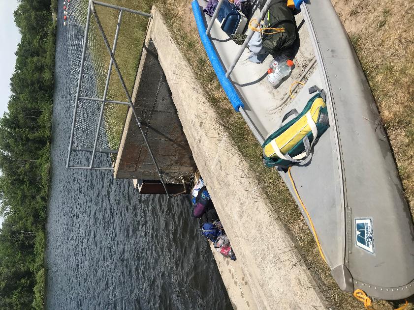
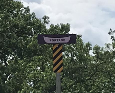
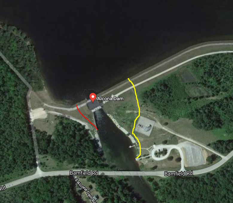
We were off! After you cross the 4001 bridge, you are officially in the Huron National Forest. It’s hillier in this section and you see a lot less homes. I don’t know if we were canoeing ourselves into shape, but we felt the best on day 3. The only problem is that we were running low on water, and now that we were in the Huron National Forest, it would be harder to come by. Today we needed to make it to just before the loud dam. Between that dam and us was 28 miles and one more dam, the Alcona. When we reached the Alcona, it was a more difficult portage. There was construction, so there was a temporary portage set up. We had to pick the boat up over a 3ft seawall, pull the boat up the levy, and then go about 400 yards down a hill back to the water. It was not ideal. The red line is where the portage is supposed to be, and the yellow line is where the re-route took us. The other thing we were quickly learning was that dam sections were bad for making progress. Portaging was slow, but the real killer is the massive lake sections that lead up to them. The river widens for 3-4 miles before each dam and there is no current to help you along.
 After we had been paddling for a while again, we started to reach water that is more stagnant. The river was marshy and wide. As we paddled along, looking forward to having 5 miles to go, we heard some yelling from the bank. As we looked closer, it turns out my mom and a friend were waiting on the riverbank for us to go by. As we get to the bank, I realize this is not a coincidence. Due to the fact that we had lost cell service for the last two days, my family was concerned for our well-being. My mom started by calling the forest service to ask if they could go look for us. Turns out, they can, but it costs $10,000. The second best thing was to wait by the river for us to go by. After proving that we were okay, it was time to get back on the river. Having stopped was a blessing in disguise, we were able to get two gallons of water that we desperately needed. We also offloaded anything we didn’t need any more to reduce weight.
 Paddling again! The rest of the way was slow going but we got there with plenty of time. The campsites in this area are all about a ¼ mile apart and have a small number plate indicating which campsite that you reserved. The wind was ripping across the lake and we had to paddle as hard as we
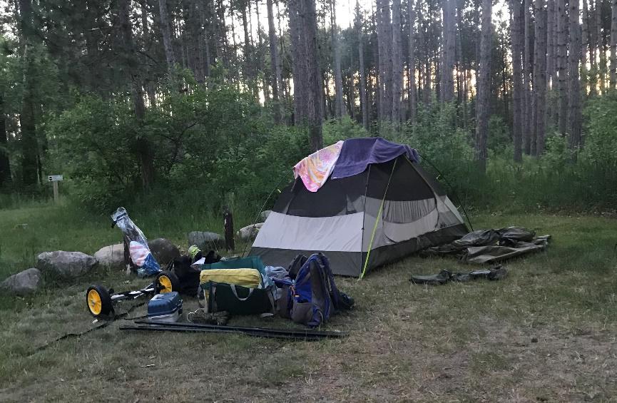
 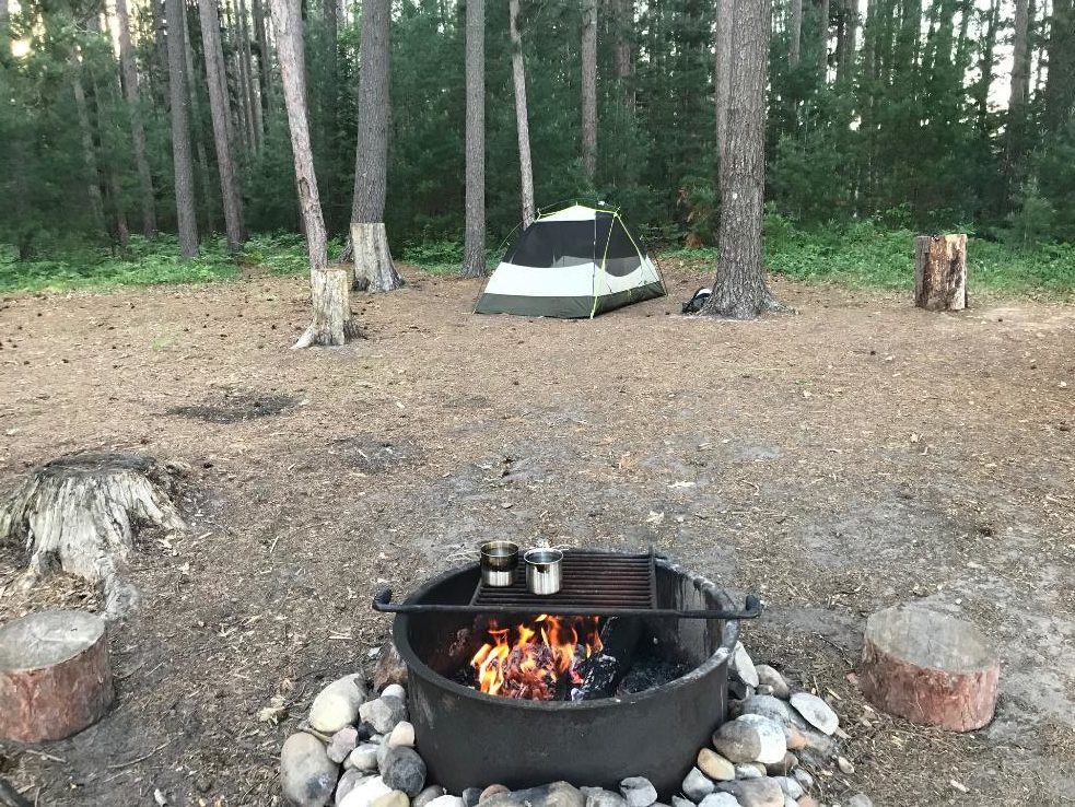 could to overcome the drag. The drag in a canoe seems much worse than when cycling. Once we made it to our campsite, it was completely worth the wait. The campsites at Loud Dam are incredible! This was our best campsite by far. They are only accessible by water and you feel like you have the place to yourself. There was a nice fire ring with grilling attachment and we even had a stack of cut firewood.
Day 4
Day 4 was easily going to be the hardest. We had learned that three things made it difficult to canoe. Portaging, lake sections and wind. On day 4 we had plenty of all three. There were 4 dams, it was almost all lake sections, and the wind that kicked up the day before was still going in the wrong direction. We were determined, but the unseasonably hot weather and long mileage was starting to take its toll on us. We portaged the Loud Dam right off the bat. This was an easy portage because of the canoe wheels we used. You put the wheels on and walk with the canoe on the boat launch road that was provided.
If you were going to canoe any section of the river, I would do the upper sections. This section is much more akin to being on a large lake. It’s still very nice and you rarely see other people. You will see many more motorized boats in this section. Some people training for the River Canoe Marathon also passed us. People do the entire 120 miles in 14 hours. I do not know how it’s even possible to go that fast, but it’s incredibly impressive! I had dreams of trying it, but I now have zero desire to try.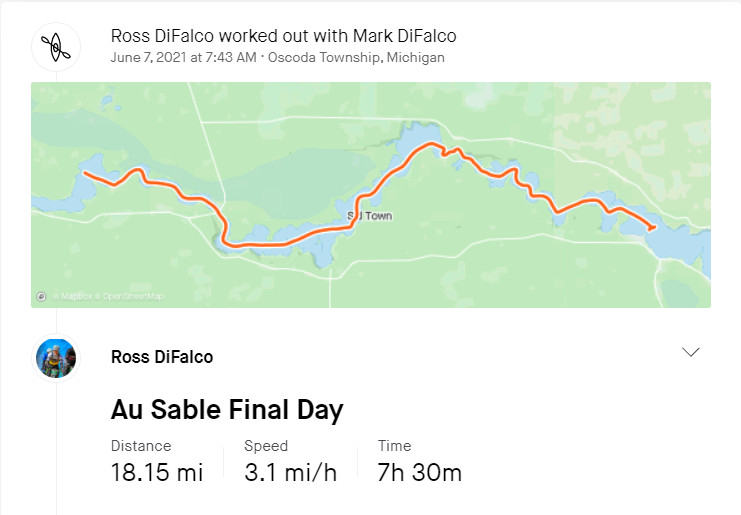
As the day progressed, we went over the Five Channels and Cooke dams and continued to chug along. The wind remained in our face and we were working harder the last day than we worked on any other day. If you have ever been to Lumberman’s Monument, we were paddling past this section of the river when we realized we had cell service. At this point, we had to decide if we wanted to make it to Oscoda or cut it early and end at the Foote Dam. We decided that we had enough fun and were going to get picked up at the next dam. This was the best decision we made. Foot Pond is massive and the wind had really picked up, and we had lightning and thunder. The boat was rocking all over the place and we didn’t feel safe in an aluminum canoe, in the middle of a lake during a thunderstorm.
Tips/Advice
- Plan and try your canoe before doing a trip – see how fast you can comfortably travel
- Canoe wheels are worth it if you portage
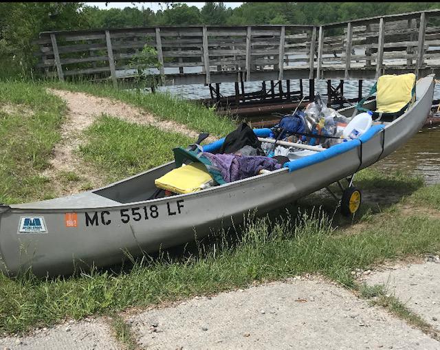
- Tie down all of your stuff
- Pull food into trees at night – we made some raccoon friends
- Create an itinerary and let people know where you are going to be (having a satellite phone would be useful too)

- Know where food and water sources are
- Have a working water purifier and have iodine as a backup
- Don’t bring fishing gear if you aren’t going to use it often
- Put sunscreen on often
- Check the flow of the river before going – the river was down and was moving slower
- I would recommend doing no more than 20 miles a day if you want to have maximum fun
Reflection
It’s a beautiful place out there. This river is vastly underutilized. If you want to go on an adventure, I would highly recommend it. Despite our blunders, I will have these memories the rest of my life. Learn from our errors and limit travels to a reasonable distance and enjoy the time on the river.